1.4. Examples#
The societal context of hydrology and its relationship with civil engineering can be clarified through a number of specific problems and use cases related to water. In the following paragraphs numerous issues and activities concerning water are addressed, which may influence the water management of a region, depending on the location. In most cases, water management is thus influenced by human actions.
1.4.1. Thermal pollution#
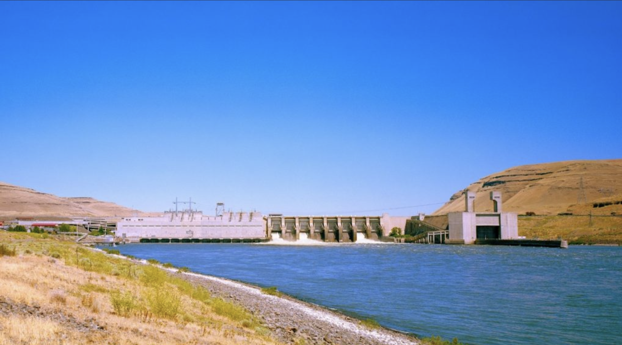
Fig. 1.3 One of the reservoirs and its dams along
the Columbia river system – photo by
(Hager and National Wildlife Federation, 2022).#
In Washington state, the Columbia and Snake rivers suffer from heat pollution. In 2015, it was estimated that the heat had killed 250,000 endangered Snake River sockeye salmon, nearly 70% of the total population. Most heat pollution comes from the dams which temporarily stop the water, causing it to soak up heat for longer time periods.
There are several promising developments that may solve the issues though, including a $2.855 billion investment in salmon and ecosystem restoration programs by the state of Washington (Hager and National Wildlife Federation, 2022).
To further understand how water bodies are affected by external effects, see Chapter 2 Hydrological cycle.
1.4.2. Drinking water supply#

Fig. 1.4 Inhabitants of Cape Town collecting water
from a local spring – photo by (Baker, 2018).#
In 2017 and 2018, Cape Town faced a severe water crisis due to poor city planning, a two-year lasting drought, and inadequate management (Baker, 2018). Residents had a 13-gallon (50 liters) daily water limit. Climate change worsened the crisis, and there was even talk of a Day Zero, where water supply would be cut completely for most people.
Residents used composting toilets and stored water, but shortages of resources like tanks and bottled water were still common. City officials struggled to respond, emphasizing the need for long-term planning and conservation.
This crisis served as a global warning about potential water scarcity in major cities. Water-saving tips and community efforts helped, but the challenge and effort was enormous.
To further understand how disruptions in the natural water cycle occur, see Chapter 2 Hydrological cycle.
1.4.3. Infrastructure#
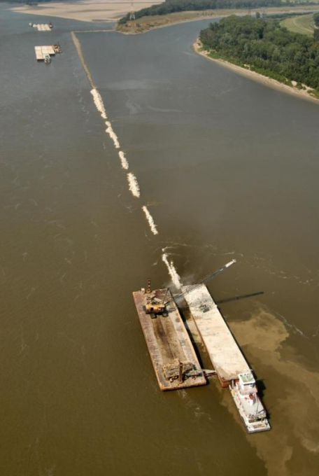
Fig. 1.5 Dredging activities in the
Mississippi river – photo
from (US Army Corps of Engineers, 2019).#
The Mississippi River and Tributaries Project (MR&T) is a large water resource management project focusing on the Mississippi River and its tributaries (Reuters, 2022). The project was initiated after devastating floods took place in 1927 to create public works aiming to provide flood risk management and an efficient navigation channel.
Among other works, the project improved the channel stabilization by providing channel cutoffs, building dikes and dredging activities to adjust the waterflow in the river (US Army Corps of Engineers, 2019). The use of hydrology to adjust the flow in the river served both for effective flood risk management and the enhancement of the river as a navigation channel.
For more information on how to manage water resources and control water flow, refer to Chapter 2 Hydrological cycle.
1.4.4. Watershed management#
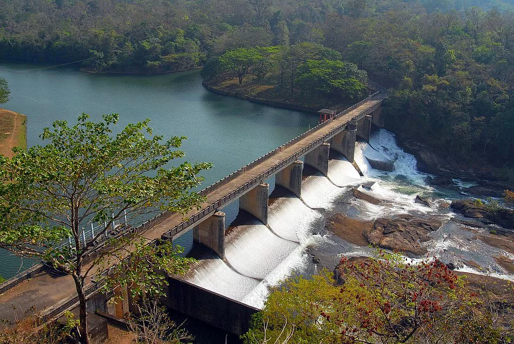
Fig. 1.6 A check dam across the Kallada river
in the Kollum district of Kerala, India.
Check dams are a common measure to reduce
water flow
velocity in a river – photo by (Vidyut, 2021).#
In 1990-1991, the Indian government launched the National Watershed Development Programme for Rainfed Areas (NWDPRA). Its main aims were to “develop the natural resource base, sustain its productivity, improve the standard of living of millions of poor farmers and landless labourers, and work towards the restoration of the ecological balance” (Sharma and Stainburn, n.d.).
The NWDPRA has had a positive impact on the watershed, including the Tribals of Chhattisgarh (Sengar et al., 2023). By succesfully managing the water resources, crop yield productivity and annual income for residents was increased.
For more information on how to manage water resources and control water flow, refer to Chapter 2 Hydrological cycle.
1.4.5. Glacier retreat and water resource uncertainty#
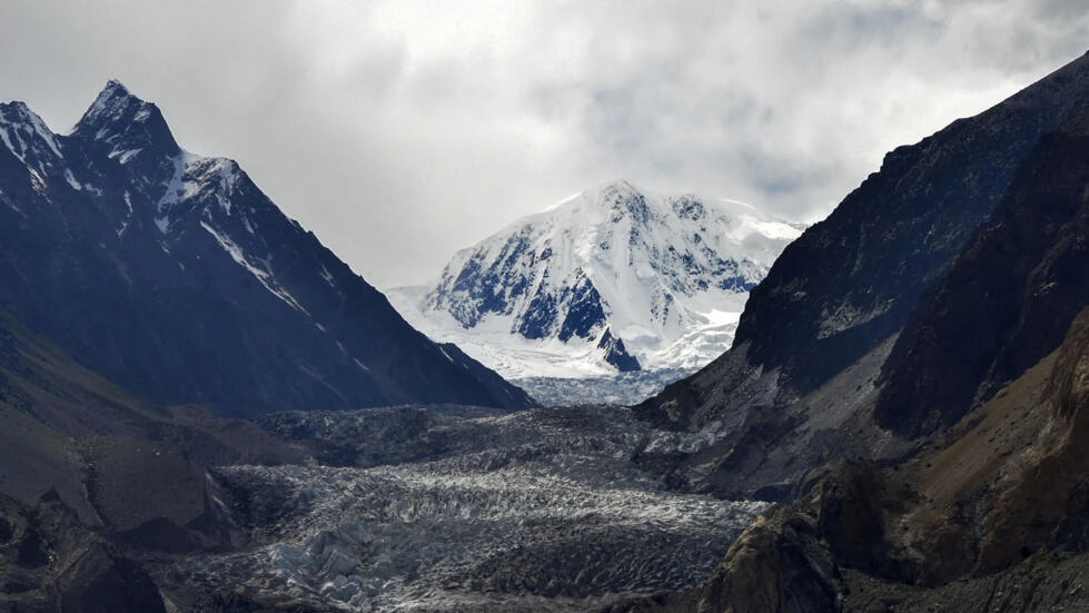
Fig. 1.7 Glacier in the Hindu Kush Himalaya
mountain range – photo by (Abdul Majeed, 2022).#
Glaciers located in the Hindu Kush Himalaya (HKH) region serve as a critical water source for over 1.8 billion people in the river valleys downstream from the mountain range (Abdul Majeed, 2022). Extrapolating the current emission trajectories sees the glaciers losing up to 80% of their storage.
As the glaciers shrink, there is a risk of initially increased water flow due to melting, followed by reduced flow as the glaciers shrink in size. Through comprehension of the dynamics of glacier shrinkage water resources can be managed more efficiently. The water management should aim to create an initial reduction in water flow to mitigate flood risks whilst improving the water security of communities downstream from this region.
Analyzing the glacier as a reservoir can provide insights into the amount of storage in the glacier over time. For more information on how reservoirs function, see Chapter 2.4 Reservoirs.
1.4.6. Irrigation#
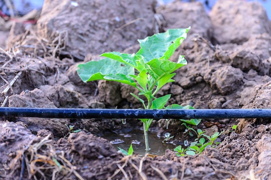
Fig. 1.8 Drip system technology in irrigation – photo by (Chu, 2017).#
A recent development in agriculture is the adoption of drip irrigation, a method that involves pumping water through thin tubes running across crops, featuring drippers along their length to dispense water directly onto the plant roots.
By optimizing this drip system, engineers at MIT found it can reduce water consumption on farms by as much as 60%, while boosting crop yields by up to 90% (Chu, 2017). This development exemplifies the importance of understanding water behavior and managing it efficiently in irrigation for more effective and sustainable agricultural practices.
In 2016, three TU Delft students under the supervision of Prof. dr. ir. Nick van de Giesen, professor at TU Delft, went to Rwanda to employ this technology on a local farm, succesfully realising an upflow gravel filter to prevent clogging in the drip irrigation system (TU Delft, 2016).
To further understand the importance of plant irrigation, see Chapter 5 Evaporation.
1.4.7. Drying out#
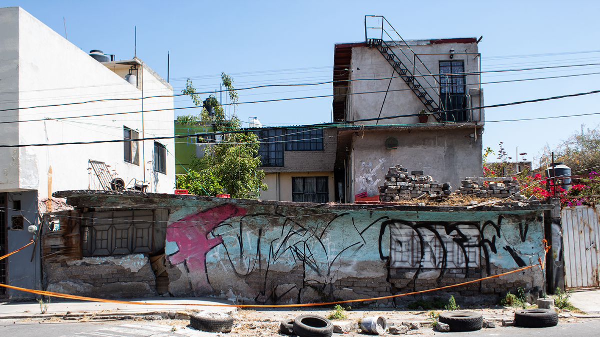
Fig. 1.9 Land subsidence causing damage in
the Ampliación Santa Marta neighborhood of Mexico City
– photo by (O'Hanlon, 2021).#
Mexico City is built on a former lakebed, and the city’s groundwater extraction has caused the land to dry out and sink by up to 10 meters feet in some areas as a result of the rapid population growth since the 1950s (O'Hanlon, 2021). The subsidence is a serious problem, since it is damaging infrastructure, causing flooding and making it more challenging to build new infrastructure.
The Mexican government addressed the issue, introducing the Green Plan project to reduce groudwater losses and repair water infrastructure (Aquatech, 2022).
For more information on how groundwater extraction works, see Chapter 6 Groundwater.
1.4.8. Saltwater intrusion#
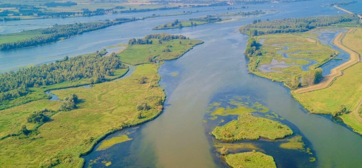
Fig. 1.10 The Rhine-Meuse Delta – photo by (Interreg, 2018).#
The Rhine-Meuse Delta in the Netherlands is at risk of saltwater intrusion as a result of climate change, subsidence of the area and water management (Interreg, 2018). Leaving this untreated may result in reduced freshwater availability, increased salinity of soil and water, corrosion of infrastructure and increased risk of flooding.
According to Deltares, water management at the Volkerak sluices and Hagestein weir proved insufficiently effective. The discharge of withdrawal of water from the river system may be more effective, though.
For more information on processes involved in groundwater, see Chapter 6 Groundwater.
1.4.9. Groundwater contamination remediation#
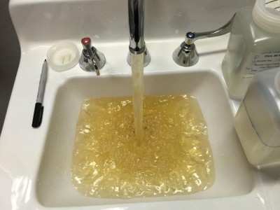
Fig. 1.11 Contaminated tapwater in Flint
– photo by (Dingle, 2016).#
In 2014, the city of Flint (Michigan) entered a water crisis when the city switched its water source from Lake Huron to the Flint River to try and save money (Dingle, 2016). The waterway, however, received raw sewage from the city’s waste treatment facility and agricultural and urban runoff, including toxics from nearby landfills.
The city has launched a groundwater remediation project to deal with the lead that leached into the groundwater which, combined with other contaminants such as PFAS, are linked with health problems. The $100 million project is currently in progress, and the city is working with the Environmental Protection Agency (EPA) to solve the issues.
For more information on groundwater, view Chapter 6 Groundwater.
1.4.10. Drainage#

Fig. 1.12 The Seine in Paris – photo by (Steenkeste, 2023).#
In many cities in Europe, among which the Spree river in Berlin (O'Sullivan, 2014), the Thames in London (Munro et al., 2019) and the Seine in Paris, outdated drainage systems are known to pollute large rivers that run through the cities.
The current mayor of Paris, Anne Hidalgo, has released plans to help reduce the pollution in the Seine (O'Sullivan, 2021). The goal is to make the river swimmable before the 2024 Olympics, aiming to use the river in the Olympic triathlon event.
The project’s main solution to the issue is to build a new stormwater holding tank with a capacity of 46,000 cubic meters, costing approximately 1.4 billion euros (O'Sullivan, 2021). Storing stormwater in the tank and pumping its contents back into the system once the storm has reduced will significantly reduce the amount of sewage entering the Seine.
Improving the drainage of a large city like Paris can significantly improve the living conditions for its residents. See Chapter 7 Rainfall runoff for more information on the rainfall-runoff processes, a crucial part of the drainage process.
1.4.11. Erosion control & Land slides#
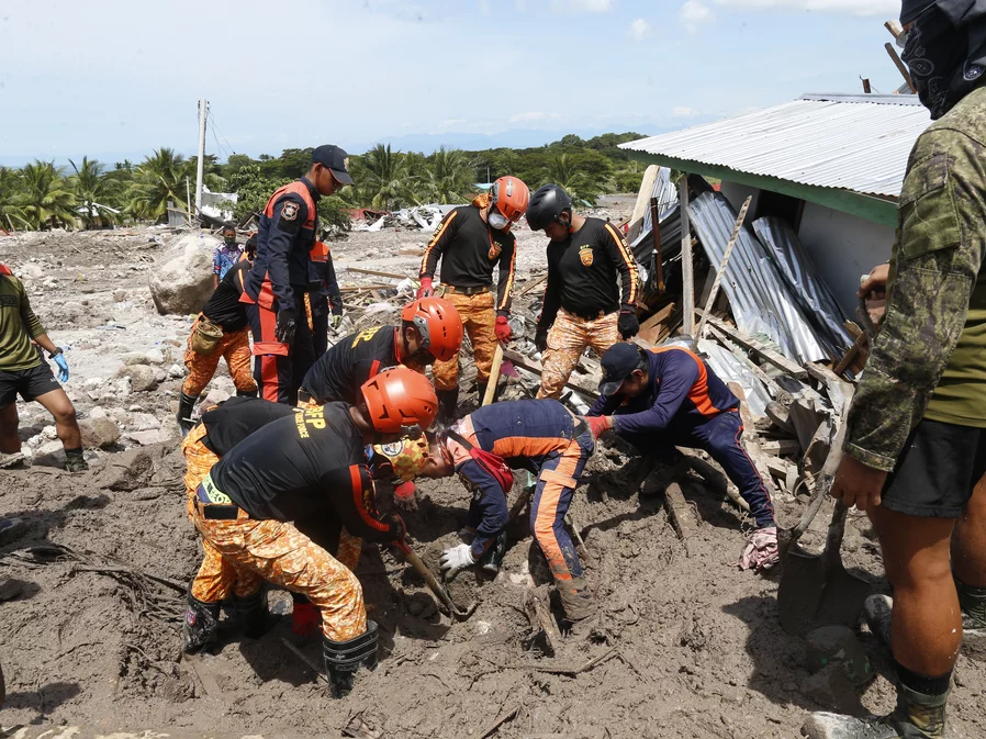
Fig. 1.13 Rescue workers investigate mud at
Maguindanao’s Datu Odin Sinsuat town,
southern Philippines – photo from (Associated Press, 2022).#
On 21 October 2022, the Philippines was struck by a devastating storm. Tropical storm Nalgae unleashed flash floods and landslides, with a particularly devastating mudslide in Kusiong village (Associated Press, 2022). This mudslide tragically claimed over 100 lives and left dozens missing, primarily in the Maguindanao province.
Kusiong village, despite its annual tsunami preparedness drills, was unprepared for the mountain-related hazards that led to this catastrophic mudslide. More extensive erosion control, for instance through the implementation of reinforced retaining walls, vegetation cover, and proper land-use planning, could have potentially mitigated the damage caused by this disaster.
To further understand how rainfall affects areas, see Chapter 7 Rainfall runoff for more information.
1.4.12. Flooding#
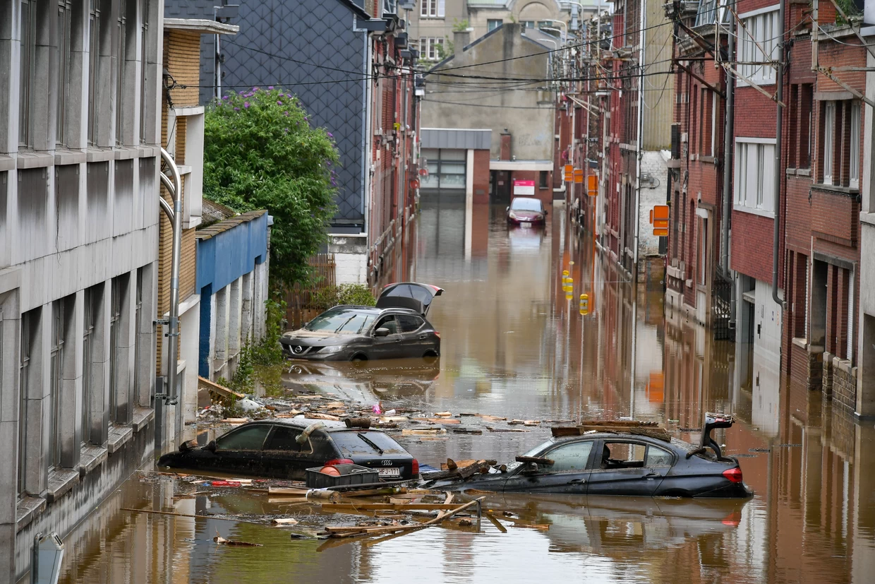
Fig. 1.14 Floodings in Limburg in 2021 – photo from (Gillet and Trouw, 2022).#
The floodings in Limburg in the summer of 2021 were a major natural disaster that affected thousands of people and caused billions of euros in damage. The flooding was caused by a combination of factors, including heavy rainfall, high river levels, and inadequate flood protection measures.
At the peak of the flooding, over 100,000 people were evacuated from their homes. The flooding also caused widespread damage to infrastructure, including roads, bridges, and power lines.
The Dutch government has taken a number of steps to improve flood protection in Limburg since the flooding of 2021 (Glas, 2023). These steps include:
Raising the height of river dikes;
Building new flood walls;
Improving flood forecasting and early warning systems;
Investing in flood-resistant infrastructure.
The measures mentioned are typical means of managing the rainfall-runoff process. See Chapter 7 Rainfall runoff for more information.
